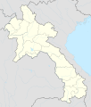
File:Laos adm location map.svg

Size of this PNG preview of this SVG file: 510 × 600 pixels. Other resolutions: 204 × 240 pixels | 408 × 480 pixels | 653 × 768 pixels | 870 × 1,024 pixels | 1,741 × 2,048 pixels | 1,961 × 2,307 pixels.
Original file (SVG file, nominally 1,961 × 2,307 pixels, file size: 477 KB)
File history
Click on a date/time to view the file as it appeared at that time.
| Date/Time | Thumbnail | Dimensions | User | Comment | |
|---|---|---|---|---|---|
| current | 16:38, 14 February 2018 |  | 1,961 × 2,307 (477 KB) | NordNordWest | upd |
| 18:36, 1 December 2014 |  | 1,961 × 2,307 (530 KB) | NordNordWest | == {{int:filedesc}} == {{Information |Description= {{de|1=Positionskarte von Laos}} {{en|1=Location map of Laos}} {{Location map series N |stretching=105 |top=22.9 |bottom=13.6 |left=99.7 |right=108.0 }} |Source={{Own using}} * United States National I... |
File usage
There are no pages that use this file.
Global file usage
The following other wikis use this file:
- Usage on af.wikipedia.org
- Usage on ast.wikipedia.org
- Usage on blk.wikipedia.org
- Usage on bn.wikipedia.org
- Usage on cdo.wikipedia.org
- Usage on de.wikipedia.org
- Luang Prabang
- Vientiane
- Savannakhet
- Pakse
- Attapeu
- Flughafen Vientiane
- Phonsavan
- Sam Neua
- Vieng Xai
- Vang Vieng
- Vorlage:Positionskarte Laos
- Thakhek
- Benutzer:Luisah/Muang Xay
- Phongsali
- Champasak (Stadt)
- Muang Xay
- Militärflugplatz Long Tieng
- Muang Sing
- Boten (Luang Namtha)
- Luang Namtha
- Pakxong
- Pakxan
- Liste der Flughäfen und Flugplätze in Laos
- Veun Kham
- Muang Khong
- Hat Xai Khun
- Nakasong
- Thakho
- Lao-Nippon-Brücke
- Set Tai
- Khinak
- Ban Houayxay
- Neues Nationalstadion von Laos
- Nationalstadion von Laos
- Savannakhet-Provinzialstadion
- Champasak-Stadion
- Muang Kham (Laos)
- Tham Kong Lo
View more global usage of this file.


